Hiking is a favourite hobby of mine. There’s nothing better than wading through nature away from civilization with some good buddies. Since this year I have been planning to write about some of the coolest hikes and adventures I have done, today this will be on Mount Te Aroha, which I have hiked up a few times now.
Te Aroha.
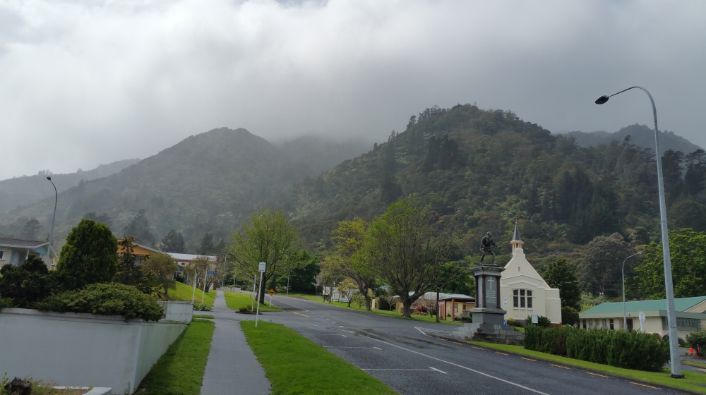
Te Aroha is a small town with just under 4000 people, with an emphasis on dairy farming, located in the extremely land-fertile Waikato region. This town is located at the base of Mount Te Aroha, where I did my walk. Aroha is a Maori word which translates to love in English. As a small farming town, the main attractions for tourists to do here are the walk and some nice mineral spas. Oh and there are some nice cafes too. But should you do the walk? Yes, you definitely should… but it does require a certain level of fitness.
Scaling the mountain!
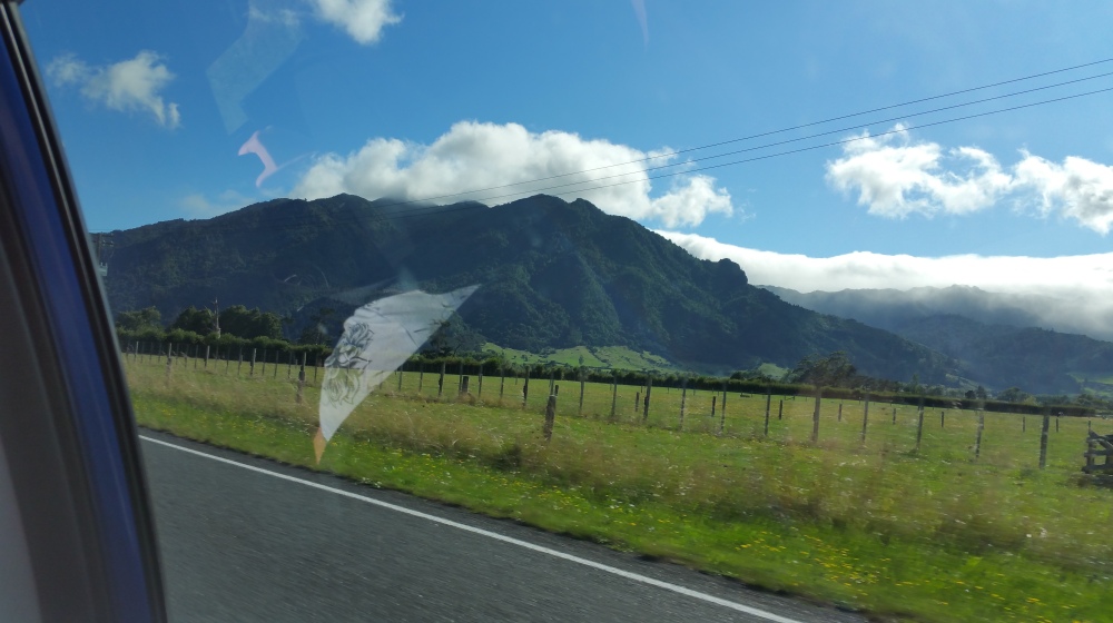
At 952 metres, Mount Te Aroha is the highest point on the Kaimai ranges. Its steep, green, imposing figure overshadows the township and intimidates newcomers who haven’t hiked it before. If you choose to take on the challenge, then be prepared for a challenge, but the rewards will more than make up for it. There are two main ways to scale this mountain:
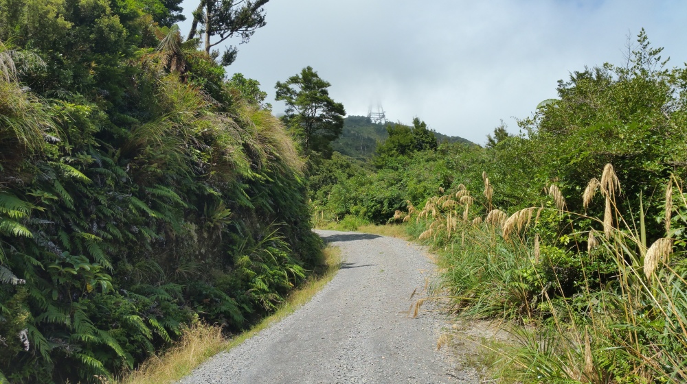
- The main route involves walking a steep track from the base of Te Aroha by the domain.
- The alternative route involves walking on a closed off road to the summit.
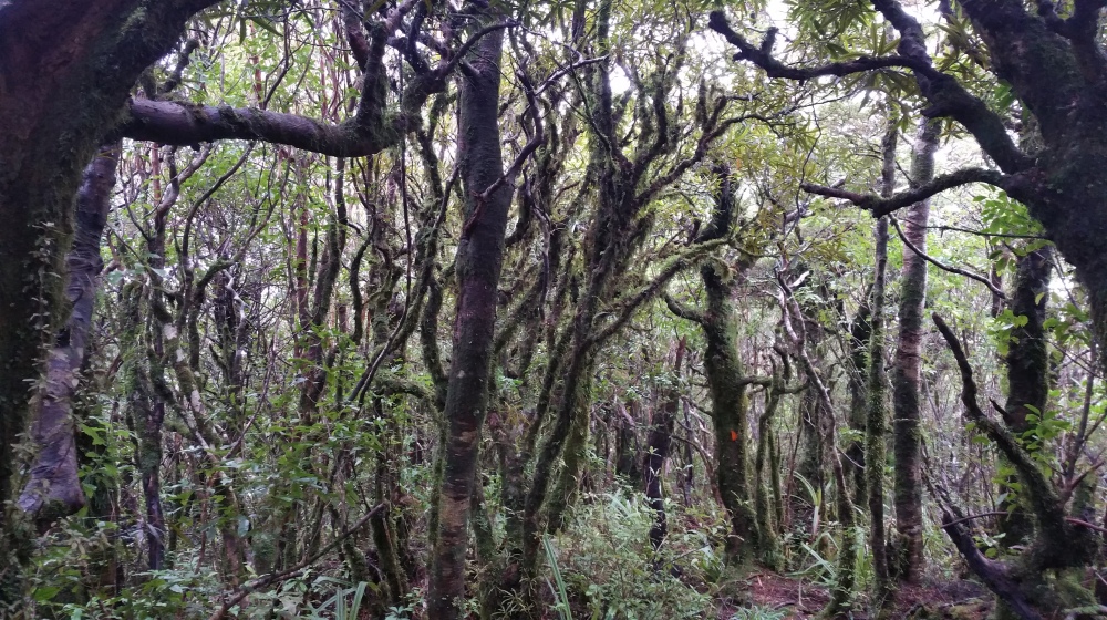
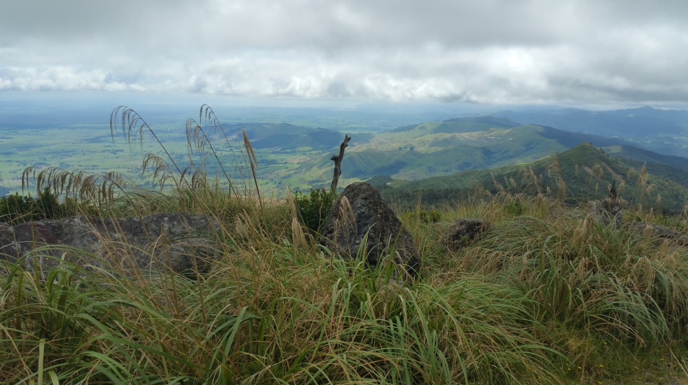
Both routes take around three hours to the summit, and you will be consistently walking uphill during this time. Imagine walking up steps for 3 hours, except instead of steps you are on a steep track. Although you could summit the mountain in under 2.5 hours if you are fit enough. I would say the walking track is better since it’s more direct and you can park near the start, you also get to walk through native NZ forest. The road way takes longer since you can’t park by the start (as far as I’m aware), and it’s not as steep, however you get better views of the surrounding countryside as you’re exposed. Anyways, time for some pictures to tell the story!
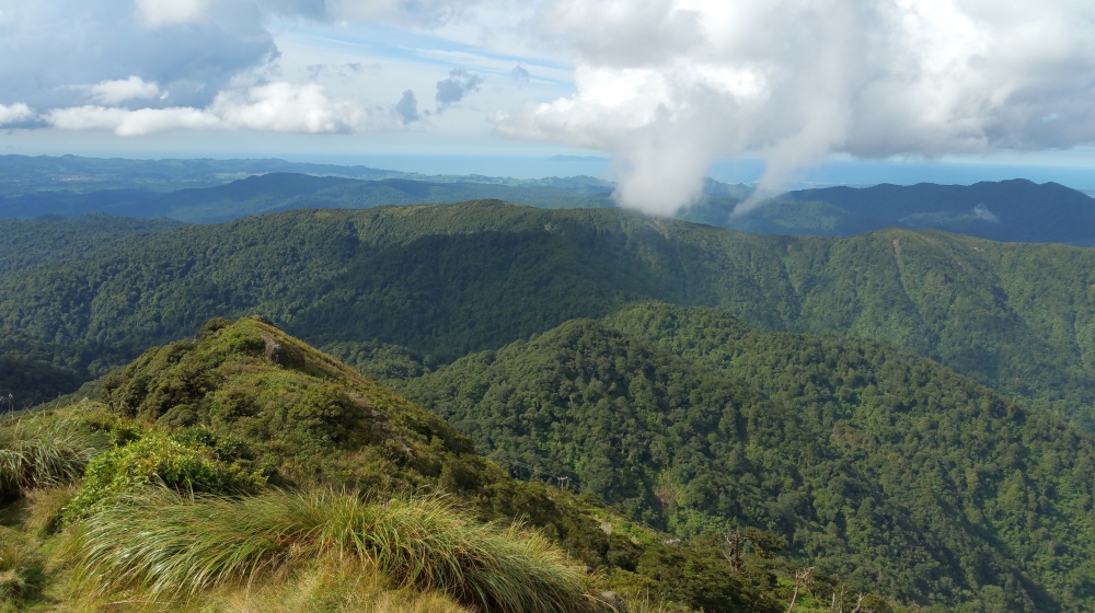
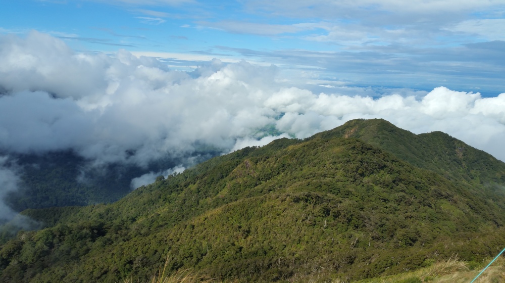
The summit.
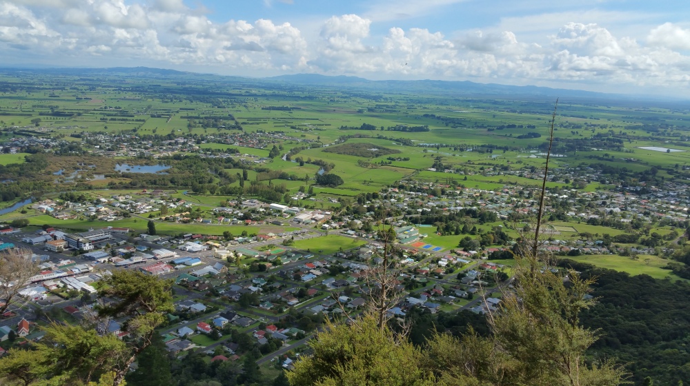
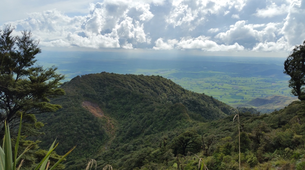
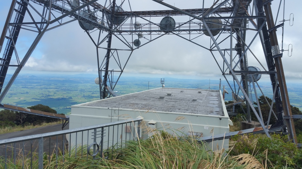
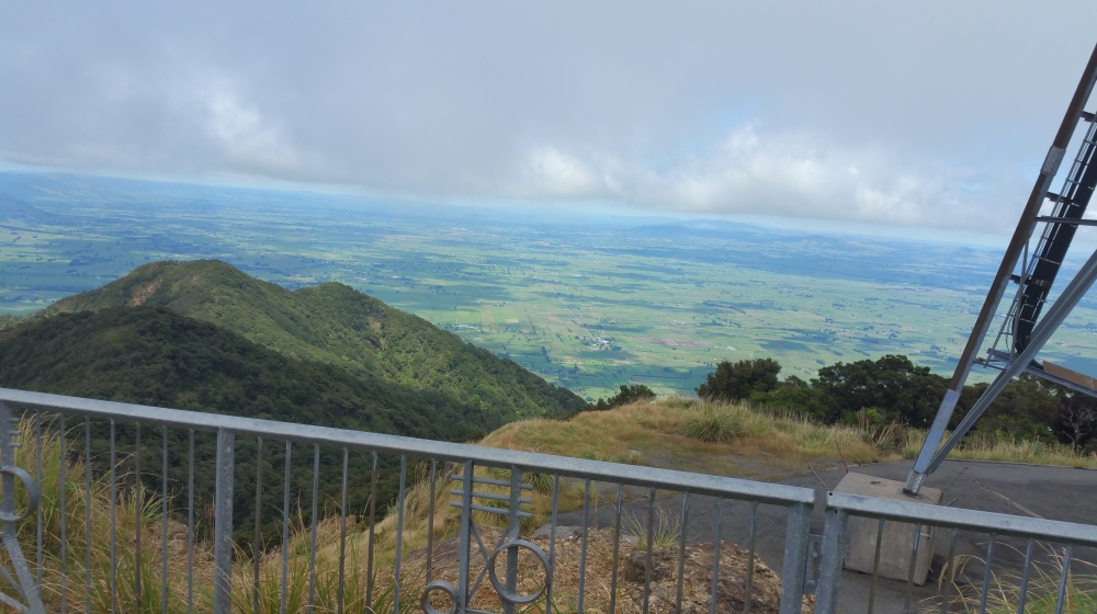
If you went the walking track way, you would find yourself under forest for most of the time, but as soon as you reach the top, you are on an exposed grassy hill with a massive communications tower. Here you will get 360 degree views of everything around you, at this height, the views you get can’t be beaten. As long as the weather is fine, I use this as an opportunity to have some lunch up there and mire the views.
Afterwards.
At the base of Mount Te Aroha there are some nice hot pools to relax in, as well as some private mineral spas to take your special someone. One time, me and some friends wanted to hike further from the summit to this hut to stay in for the night. That took an extra four hours and really took the energy out of us!
I have been on several other walks which I can share with you later. Which walks? You will see!
